 2009 Bolivia Rainforest: Coroico
Corey Lablans Photography
In August 2009, Carlea and I traveled to Bolivia. I will say this trip came out of the blue and ended up being one to remember for a lifetime. Honestly I really did not know where Bolivia was located before this adventure.
Carlea, had spent three months in Bolivia (t hink two years past) and she wanted to visit a friend. Asking me to come along, cause of my adventurous personality, she knew I would say yes. Essentially if I was able to get the money together, I would go. After being asked to go, the first thing I did was search on GOOGLE, where Bolivia was.
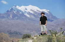
Bolivia was an amazing country to visit, we explored the highest capitol on the world, La Paz at an altitude of almost 13,000 feet. Then we visit the highest navigable lake, Lake Titicaca and biked down one of the world's most dangerous roads nicknamed "The Road of Death" to Coroico, at an altitude of approximately 5,000 feet. These photos are some of the only digital photos I took on the trip and they are of Coroico.


Carlea, had spent three months in Bolivia (t
 hink two years past) and she wanted to visit a friend. Asking me to come along, cause of my adventurous personality, she knew I would say yes. Essentially if I was able to get the money together, I would go. After being asked to go, the first thing I did was search on GOOGLE, where Bolivia was.
Bolivia was an amazing country to visit, we explored the highest capitol on the world, La Paz at an altitude of almost 13,000 feet. Then we visit the highest navigable lake, Lake Titicaca and biked down one of the world's most dangerous roads nicknamed "The Road of Death" to Coroico, at an altitude of approximately 5,000 feet. These photos are some of the only digital photos I took on the trip and they are of Coroico.


Great photos, good job! :)
ReplyDelete